City is proposing zoning changes for Uptown commercial corridors

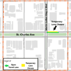
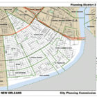
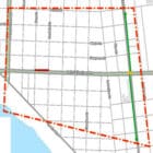
The city is proposing zoning changes for a few Uptown commercial corridors that would allow more housing in these areas. The City Planning Commission discussed these and other potential amendments to the city Master Plan last week at a public meeting held at the International School of Louisiana. The meeting was for Planning District 2, which includes  Central City, the Lower Garden District, St. Thomas, the Irish Channel, the Garden District, Milan, Touro-Bouligny, East Riverside and the Hoffman Triangle.  A few dozen residents showed up for the opportunity to see the proposed amendments in their district and provide feedback. The Master Plan, a policy and planning document, is subject to regular revision.

Join us in exploring the Many Lives of Charity Hospital, hosted by Chelsey Richard Napoleon, Clerk of Civil District Court (sponsored)

The Honorable Chelsey Richard Napoleon is excited to announce this year’s Archives Month showcase! Email your interest in experiencing this new showcase: civilclerkresearchctr@orleanscdc.com
The Notarial Archives Research Center is located in our Land Records Division. These documents, which date back to the 1700s, represent the rich history of New Orleans. The archives can be used for property, genealogical, architectural and landscaping research, among other subjects. The Land Records Division is where documents regarding property are recorded.

City is remaking its parks and recreation. And it wants your input.

A new master plan for the city’s parks, The Big Green Easy project, is in the works. The city’s Office of Youth and Families and the New Orleans Recreation Development (NORD) Commission — in partnership with Parks & Parkways, the City Park Commission and the Audubon Nature Institute — is now taking the first step: collecting public input on the public’s vision for the green space and recreation opportunities. The citywide plan is part of the 2019  parks and recreation millage proposal that passed with 76% voter approval. Public input is a core part of the project. A series of public meetings and an online survey will help shape the master plan.

Roadwork ahead: Lanes closed on St. Charles Avenue near MLK Boulevard

The city has temporarily closed alternating uptown bound travel lane on the 1400 block of St. Charles Avenue, approaching Martin Luther King Jr. Boulevard. The closure to accommodate asphalt paving operations will last all day on March 2, until 5:30 p.m.
Vehicles parked on the 1600-1800 blocks of Martin Luther King Jr. Boulevard between St. Charles Avenue and Oretha Castle Haley Boulevard should be moved off the street, and the Department of Public Works asks that residents adhere to the “no parking” signage on the streets. Vehicles parked in these zones will be ticketed and towed.

City nixes the Columns’ front yard seating

The Columns’ graceful front porch, framed by the columns that give the hotel its name, has long been popular spot for celebrations, date nights or just sipping a cocktail on a balmy evening as the St. Charles Avenue streetcar rumbles by. 
It’s so popular that the current owners expanded the outdoor seating into the front yard. As part of a 2020 renovation after the hotel, bar and restaurant changed hands, they installed pavers to create new seating. 
In Uptown Messenger’s December 2020 story on the renovation, reporter Sue Strachan wrote: “One of the changes people see right away is the entrance: In the past, guests would enter via a central walkway flanked by greenery. The new entrance has moved to the side with the greenery and walkway replaced with a brick patio. This allowed a more controlled flow into the building, and more outdoor seating.

City seeks public input on zoning changes at Master Plan meeting

The city is asking for public input on zoning changes in the planning district that includes Central City, Lower Garden District, St. Thomas, Irish Channel, Garden District, Milan, Touro-Bouligny, East Riverside and Hoffman Triangle. The New Orleans Master Plan and Future Land Use Map are the primary policy and planning documents for land use and development in the city. They set up guardrails for the types of zoning districts that may be applied in your area. In 2008, voters approved an amendment to the City Charter requiring land use actions to be consistent with the Master Plan’s Future Land Use Map.

Roadwork ahead: Lane closure in the 7800 block of St. Charles Avenue

The westbound lanes of St. Charles Avenue from Burdette Street to Fern Street will be temporarily closed beginning at 7 a.m. on Monday (Feb. 270. The closure will last for approximately four weeks to accommodate a waterline tie-in and roadway restoration work as part of the Black Pearl Group B construction project. The road closure is expected to remain in effect until Friday, March 24 at 5:30 p.m. Signage and traffic control measures, such as barrels and fencing, will be onsite to direct drivers and pedestrians.

Public safety, crime reduction to be explored at Coffee on Your Corner

Public safety officials will take your questions on Thursday (Feb. 23) at the next Coffee on Your Corner with the District B Neighborhood Engagement Office. Representatives with the Violent Crime Task Force and with NOLA311 will meet with citizens. Mayor LaToya Cantrell formed the Violent Crime Reduction Task Force, under the command of Orleans Parish Communication District Executive Director Tyrell Morris, in January to strategize methods of crime prevention. Morris will present updates at the meeting, according to Kevin J. Kellup, the neighborhood liaison for District B. Kellup said 15 to 20 District B community leaders will also participate.